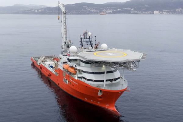
What many of us have been encouraging has finally transpired–the seabed search for the wreckage of MH370 has been re-started. The search vessel Seabed Constructor has just arrived in the new search area, outfitted with a team of eight autonomous underwater vehicles (AUVs). Ocean Infinity, the company under contract with Malaysia to conduct the search, has agreed to start by searching the 25,000 square kilometers identified by the ATSB and CSIRO as most likely. Included in that area are three locations that CSIRO has identified as high priority, as determined from satellite images of floating objects and complex drift models. Last August, the highest priority location was described by CSIRO’s David Griffin in these words: We think it is possible to identify a most likely location of the aircraft, with unprecedented precision and certainty. This location is 35.6[degrees south], 92.8 [degrees east].
At Ocean Infinity’s touted scan rate of 1,200 square kilometers per day, the entire 25,000 square kilometers would be completed in 21 days of searching, and the highest priority area of 5,000 square kilometers would be completed in less than a week.
The nominal location of the 7th arc that is shown in the figure above is a based on the assumption that the last transmission from the aircraft occurred at 20,000 ft, and our best estimate of the final BTO value is 18390 μs. The final two BTO values that were used for the best estimate occurred when the SATCOM of MH370 initiated a log-on to Inmarsat’s satellite network at 00:19 UTC on March 8, 2014, minutes after the engines stopped due to fuel exhaustion. (The re-boot of the SATCOM likely occurred after the APU automatically started and briefly supplied electrical power.)
I performed a statistical analysis of previous log-on events that occurred on March 7, 2014, including those that occurred on flight MH371 from Beijing to Kuala Lumpur. Using the results of this analysis, the final two BTO values from MH370 were first corrected and then appropriately weighted based on their respective uncertainties in order to arrive at the best estimate of 18390 μs. The procedure was briefly described in a previous comment of mine.
Also shown in the figure are two other arcs that are positioned at +/- 25 NM from the nominal location of the 7th arc. These might serve as limits for some parts of the search. The figure shows that the +/-25 NM limits do not correspond to the boundaries of the 25,000 square kilometer area that was previously identified. In fact, the highest priority location identified by CSIRO (labeled CSIRO Priority 1) falls slightly outside of the 25-NM outer limit.
If not found in the initial 25,000 square kilometer area, the contract with Ocean Infinity indicates that the search will continue further northeast along the 7th arc. Likely, the search will continue along the 7th arc as far northeast as time and weather permit.
I often get asked whether I believe this search will succeed in finding the wreckage of MH370. I long ago arrived at the conclusion that based on the evidence we have, it is impossible to determine any one location with a high level of certainty, and I stopped trying. The satellite data and the drift models allow a broad range of possible impact sites. Within that range, there are at best some “warm spots” that are based on assumptions about navigation inputs. So, it becomes a numbers game–the more area searched, the higher probability of finding the wreckage. I subjectively believe there is a 33% chance of finding the wreckage in the first 25,000 square kilometers. If there is time and money to search at +/- 25 NM from the 7th arc all the way to a latitude of 26S, I subjectively put the chances of success at around 67%. That might seem like bad odds, but realistically, that’s higher than they’ve ever been.
The highest priority location identified by CSIRO is about 66 NM from Seabed Constructor’s present location, and might be reached within the next day. We’ll all be watching.
[Don Thompson reminds me that the data from an AUV mission is available only after the AUV is recovered after the completion of a dive, which could last 2+ days, based on the endurance of the batteries. It might take another 18 hours to analyze the data. That means that although the AUVs could reach “CSIRO Priority 1” by tomorrow, we would not know until Wednesday or Thursday whether or not the debris field was found.]


